M6.8 earthquake and tsunami rocks lower South Island
On Tuesday afternoon, 25 March, at 2:43PM we recorded at M6.8 earthquake with moderate shaking 167 km west of Rakiura Stewart Island. It was felt widely throughout the lower South Island, and generated a small tsunami.
Our Tsunami Expert Panel assessed the tsunami potential of the M6.8 earthquake and provided advice to NEMA who issued a national advisory expecting the West Coast of the South Island from Milford Sound to Puysegur Point to experience strong and unusual currents and unpredictable surges at the shore. For more on this and the latest information see:civildefence.govt.nz
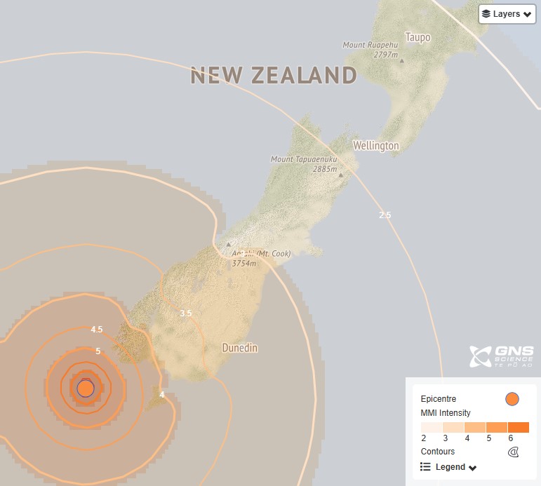
Shaking Layers map of the M6.8 earthquake
Our coastal sea level gauge in southwest Fiordland recorded a 10 cm tsunami continuing for 90 minutes after the earthquake.

How the tsunami showed up on our Puysegur tsunami gauge
With our monitoring equipment we have recorded 23 aftershocks by 8:00am this morning, the largest was a M5.1 at 10:01pm on Tuesday 25 March.
Thanks to those who completed our Felt Detailed reports after the earthquake. We received over 200 responses, and you can see how they experienced the shaking in the image below.
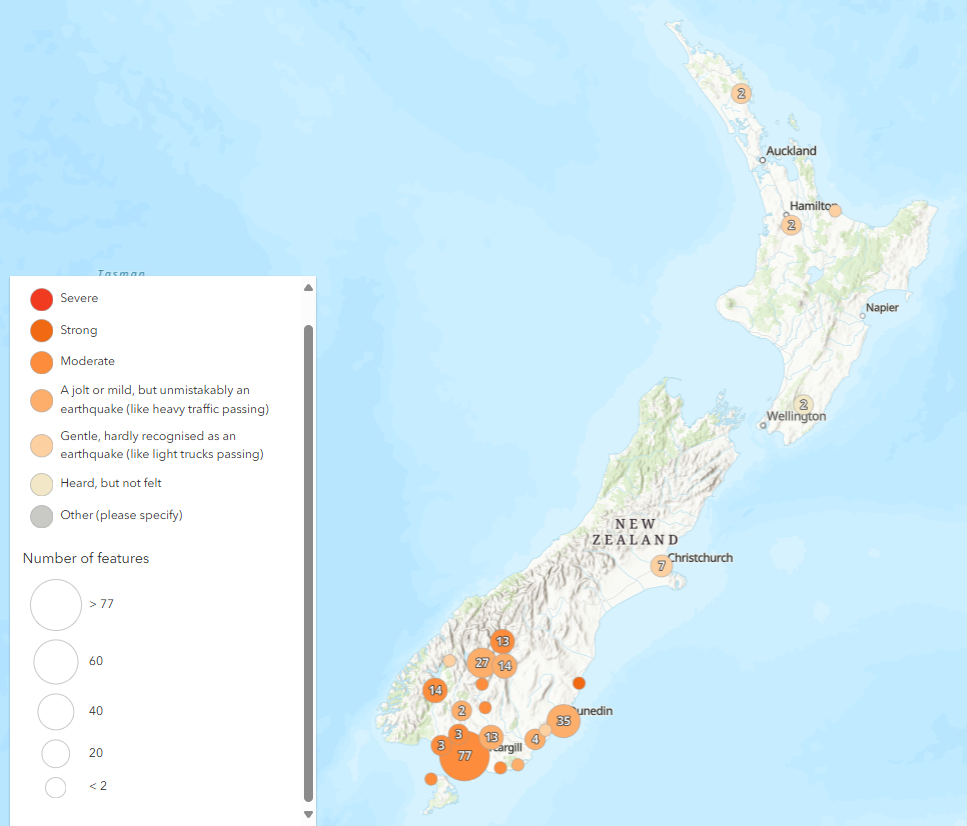
Felt Detailed shaking responses
If you observed any tsunami activity following the M6.8 earthquake we would love to know, please fill in our Tsunami Observation Report.
Is there anything to indicate that we should expect more quakes in that area?
This earthquake has occurred in an area of active subduction. At this point in time, it is hard to say whether this earthquake has occurred on the plate interface or on an overlying fault. Both uncertainty in the earthquake depth and a limited understanding of the shape of the plate interface at depth contribute to this.
In any case, it serves as a reminder that the plate boundary south of the South Island is active, significant and hosts the potential for large, tsunamigenic earthquakes.
Earthquakes like this have occurred in the past and will occur again. The plates are converging at about 35 mm per year at this boundary and earthquakes, like we felt yesterday, are a consequence of this converging movement. While we know a lot less about the tectonics of this region owing to its remote and underwater location, we should treat it just like we do our more familiar plate boundaries: as a region where large earthquakes and tsunami are expected and should be prepared for.
Why worry about such a small tsunami?
A 10 cm tsunami isn’t likely to cause much inundation outside of the intertidal area or a bit above it. In terms of water height, it’s not a big wave and most coastal areas have developed to accommodate larger waves in storms. Natural features like rocky shore platforms, beach slopes and dunes do this, plus whatever people might have built.
There are areas where a small tsunami like this can have a big effect in terms of inundation. Tight bays and harbours can trap and focus tsunami energy so what comes up at the shore there is larger than what is arriving out at more open coastlines.
The tsunami gauge at Puysegur Point where we measured the 10 cm wave is just one spot, and the tsunami height can vary a lot between different bays and inlets, so for this reason the tsunami could well have been larger at some other locations nearby.
A 10cm tsunami may not seem like much, but that small tsunami can move a lot of water. Surges come in over several minutes, and then recede just as fast for a similar time period, often acting more like a very rapid tide than an ocean wave. Think of being in such a surge as like wading through a fast-flowing river. That’s where the advisory to stay clear of the ocean during even a small tsunami comes from. It might only be ankle deep at the beach, but you could find yourself swept out to sea by the force of the currents if you are in the water or in a small boat.
Where are the Snares Islands?
Snares Islands/Tini Heke are about 100 kilometres south of Stewart Island. The Snares are New Zealand’s northernmost subantarctic islands and are often used as the geographic reference point for quakes that occur many kilometres south of New Zealand.
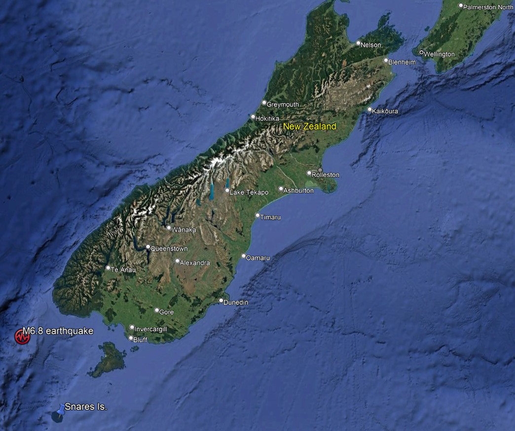
Location of the M6.8 earthquake
In this region, the Australian Plate is subducting eastward under the Pacific Plate and causes stress and pressure throughout the region that is released as earthquakes. This is the same process but in the opposite direction to what is happening beneath the North Island and the top of the South Island, where the Pacific Plate is subducting westward under the Australian Plate.
The plate boundary in this southern region is called the Puysegur Trench. In the middle of the South Island, both tectonic plates are sliding past each other along the Alpine Fault.
A tsunami that has been generated by an earthquake in or near New Zealand could arrive within minutes. This is why it's important to know the natural warning signs of tsunami and act quickly. If you are near the coast and feel a long or strong earthquake move immediately to the nearest high ground, or as far inland as you can.
Learn: About tsunamis, learn the warning signs and the right action to take
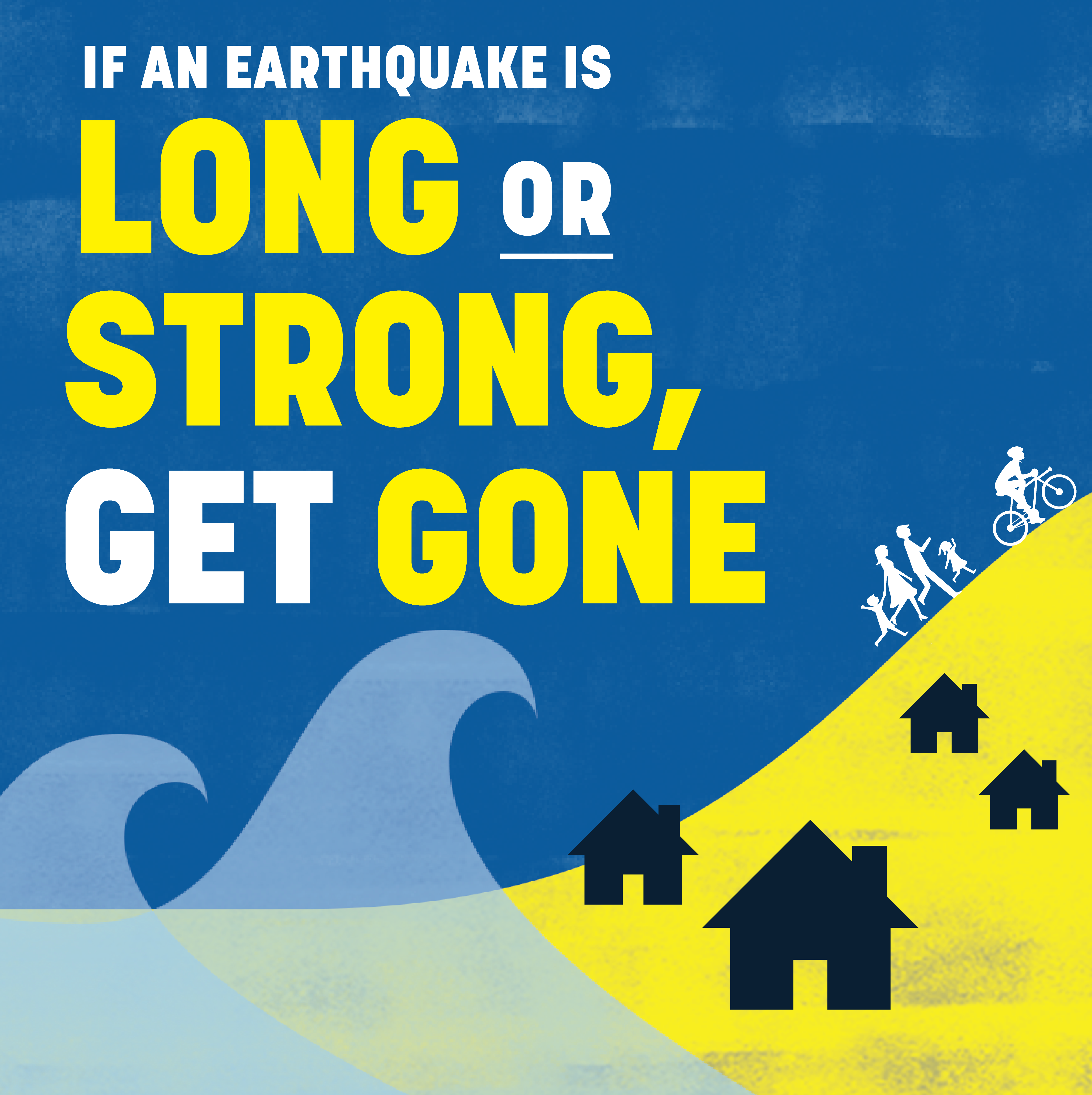
Long or Strong, Get Gone
Was it the biggest quake of the year so far?
This is the largest earthquake this year in the South-West Pacific where we monitor. Other notable earthquakes include the M5.3 Eketahuna earthquake (January) and the M5.1 Culverden earthquake (6 March) each having over 100x less energy than yesterday’s earthquake.
We can’t prevent natural hazards, but we can, and should, be prepared for them
Remember Long or Strong, Get Gone : If you are near the coast, or a lake, and feel a strong earthquake that makes it hard to stand up OR a weak rolling earthquake that lasts a minute or more move immediately to the nearest high ground or as far inland as you can, out of tsunami evacuation zones.
For information on preparing for earthquakes or tsunami, there are guidelines from the National Emergency Management Agency's (NEMA) Get Ready website.
Prepare your home. Protect your whānau. There’s a lot we can do to make our homes safer and stronger for earthquakes. Natural Hazards Commission Toka Tū Ake's website has key steps to get you started.