Mt Ruapehu - Silica Rapids water sampling
Updated: Thu Aug 1 2024 11:40 AM
With new and emerging technologies there are many ways we can now remotely monitor volcanoes; however, some areas still require us to visit to take samples at volcanos to create the full picture of volcanic activity.
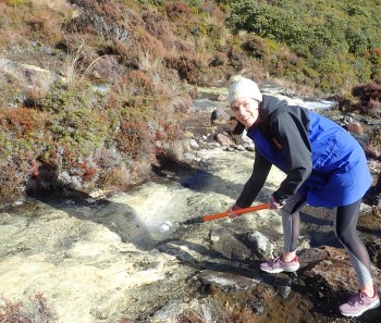
We tagged along with GNS Science Volcano Geochemistry Technician, Karen Britten to better understand water sampling from Silica Rapids at Mt Ruapehu.
Mt Ruapehu has an active hydrothermal system within the volcano, this system is most well-known via the summit crater lake (Te wai-a-moe). This system also ‘leaks’ from the volcano at several places, and Silica Rapids is one of these, this is why we collect water samples from here.
The value of water sampling
Water samples are collected from Silica Rapids yearly. During each trip, the temperature of the water is recorded and then a variety of samples are collected. Some of these samples need different treatments back at the lab, so various samples are taken.
Small rubber sealed bottles, which exclude air, are taken for pH, bicarbonate, and hydrogen sulphide. Two small portions are filtered for anion and cation analysis and finally a sample is taken for isotope analysis.
Monitoring these specific analyte concentrations and any changes provide insight into processes related to any unrest or volcanic activity.
This water sampling information is then combined with our other monitoring data to help our volcano team better understand the hydrothermal system within the volcano which then informs volcanic alert levels, aviation colour codes and other public information.
Interested in the Data?
Read a data blog on Silica Rapids here.
More about Silica Rapids
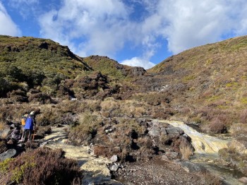
Silica Rapids are found on one of the many popular walks at the base of Mt Ruapehu. They are known for their creamy white stream bed covering. This creamy deposit comes from a process where gassy, silica / aluminium-rich water pours out of a spring, the gas then starts to escape, and the minerals become less soluble and are left behind on the rocky surfaces of the stream. The more turbulent the flow, the more gas is lost, and this speeds up the mineral deposition. This is why the white colouration is so prominent on the stream bed of the Silica Rapids.
Want to visit? The Silica Rapids Walk - Department of Conservation
How we keep an eye on Ruapehu
GeoNet monitors Ruapehu volcano and Crater Lake (Te Wai ā-moe) remotely via seismic, acoustic, GNSS (GPS) and ScanDOAS sensors around the volcano. The temperature and water level of the lake are also monitored by a datalogger at the lake outlet sending regular data to the GeoNet volcano team. Our Volcano Monitoring Group routinely take gas flights and sampling of the crater lake.
You can check out the latest updates on the volcano via the Volcano Activity Bulletins here.
Find out more about Mt Ruapehu and other New Zealand volcanoes here.
Planning on visiting Mt Ruapehu?
For information on access to the Mt Ruapehu area, please visit the Department of Conservation’s website on volcanic risk in Tongariro National Park and follow their Facebook page for further updates.
Being Prepared
The National Emergency Management Agency's (NEMA) Get Ready website has information on what to do before, during and after volcanic activity.
During volcanic activity, follow official advice provided by your local Civil Defence Emergency Management Group, the Department of Conservation (for visitors to the Tongariro and Taranaki National Parks), local authorities and emergency services.
Prepare your home. Protect your whānau.
There’s a lot we can do to make our homes safer and stronger for hazards. The National Hazards Commission Toka Tū Ake's website has key steps to get you started.
Media contact: 021 574 541 or media@gns.cri.nz


