
More faults, more resolution, more features – the NZ Active Faults Database webmap gets a major upgrade
Welcome, haere mai to another GeoNet Data Blog. Today’s blog is a little bit different. GNS Science’s NZ Active Faults Database (NZAFD) is not a GeoNet data product but if you like earthquake data as much as we do, you will likely find this dataset a useful tool to use in tandem with our earthquake products.
A recent upgrade to the NZAFD webmap has added a high-resolution (1:10,000 scale or better) active fault surface trace layer for the Hawke’s Bay, Manawatū-Whanganui (Horizons), Tairāwhiti Gisborne and Wellington regions, as well as the northern Alpine and Wairau faults – meaning thousands more active fault traces can be viewed right down to the property scale in these regions.
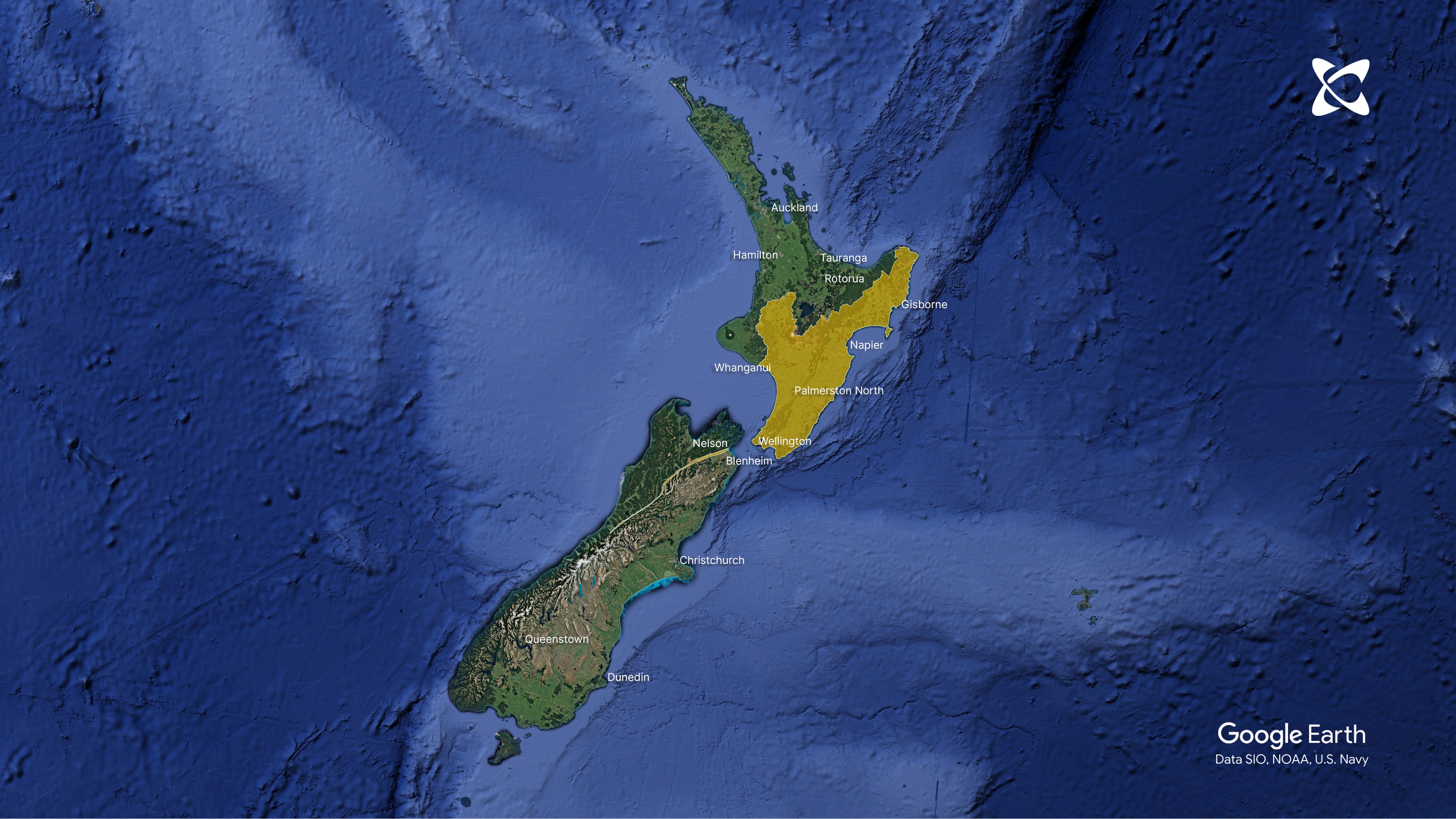
Map of areas with high-res scale data
If you have ever wondered if you have a fault trace running through your backyard, this is the tool for you. More areas will be added over time, so stay tuned if your part of New Zealand isn’t on our high-res layer yet.
The active faults identified in the database are those that have ruptured the ground surface during previous large earthquakes and are considered likely to rupture in the future. This is good intel to help people make informed decisions about where to build and make existing infrastructure more resilient to the effects of earthquakes.
Where available, the webmap also includes Fault Avoidance Zones and Fault Awareness Areas for the high-resolution active fault layer, useful land-use planning tools for mitigating surface rupture hazard.
How to use the webmap
To access the new layers, simply visit the NZAFD webmap here and zoom into any of the regions included in the upgrade. The NZAFD 1:250,000 scale dataset is turned on by default and once zoomed in far enough, the high-resolution layer options will automatically turn on (see figure 1).

High-resolution layers on the New Zealand Active Faults Database (NZAFD) webmap
Where available, each fault trace also includes attributes that describe the expected rupture frequency, slip rate, last known event and other parameters useful for risk assessments (see figure 2).

Zoomed in view of the high-resolution layers on the New Zealand Active Faults Database (NZAFD) webmap, showing a pop-up containing attributes for the Fault Avoidance Zones and high-resolution surface traces
While many of the high-resolution datasets are currently available on respective regional and local council digital platforms, the enhanced GNS webmap makes this information available in a single publicly accessible location accessed on a visually interactive platform.
Associated reports can also be downloaded for the high-resolution layers via pop-ups in the GNS webmap, where available.
Users of this GNS webmap will see consistent symbology and attribute information, making it a trusted, up-to-date and consistent source of truth for active faults in New Zealand.
Other enhancements users will see are more regular updates of the existing NZAFD 1:250,000 scale dataset that can be downloaded, along with more explanatory information (metadata) about each dataset and how it can be used.
That’s it for now
We hope you find the upgraded active faults webmap an intriguing tool to explore and useful for your earthquake hazard information needs.
You can find our earlier blog posts through the News section on our web page, just select the Data Blog filter before hitting the Search button. We welcome your feedback on our data blogs and if there are any GeoNet data topics you’d like us to talk about please let us know! Email us at info@geonet.org.nz
Ngā mihi nui.