Pioneering science readying Aotearoa for the next ‘big one’
This week ShakeOut, our national earthquake drill and tsunami hikoi, takes place on Thursday 24 October. It is a chance for New Zealanders to practice their best drop, cover, hold and refamiliarise themselves with their tsunami evacuation routes.
While ShakeOut comes round once a year, GNS Science is always preparing for the next big earthquake – honing our response capabilities with simulated exercises and advancing our expertise and tools through pioneering research.
Earlier this year GNS Science joined Exercise Rū Whenua 2024, a national response exercise led by the National Emergency Management Agency (NEMA) and involving 150 organisations. The exercise simulated a magnitude 8.1 rupture of the Alpine Fault and GNS had a critical role to play in responding – rapidly developing accurate earthquake and tsunami insights, providing this advice to responding agencies and communicating the science.
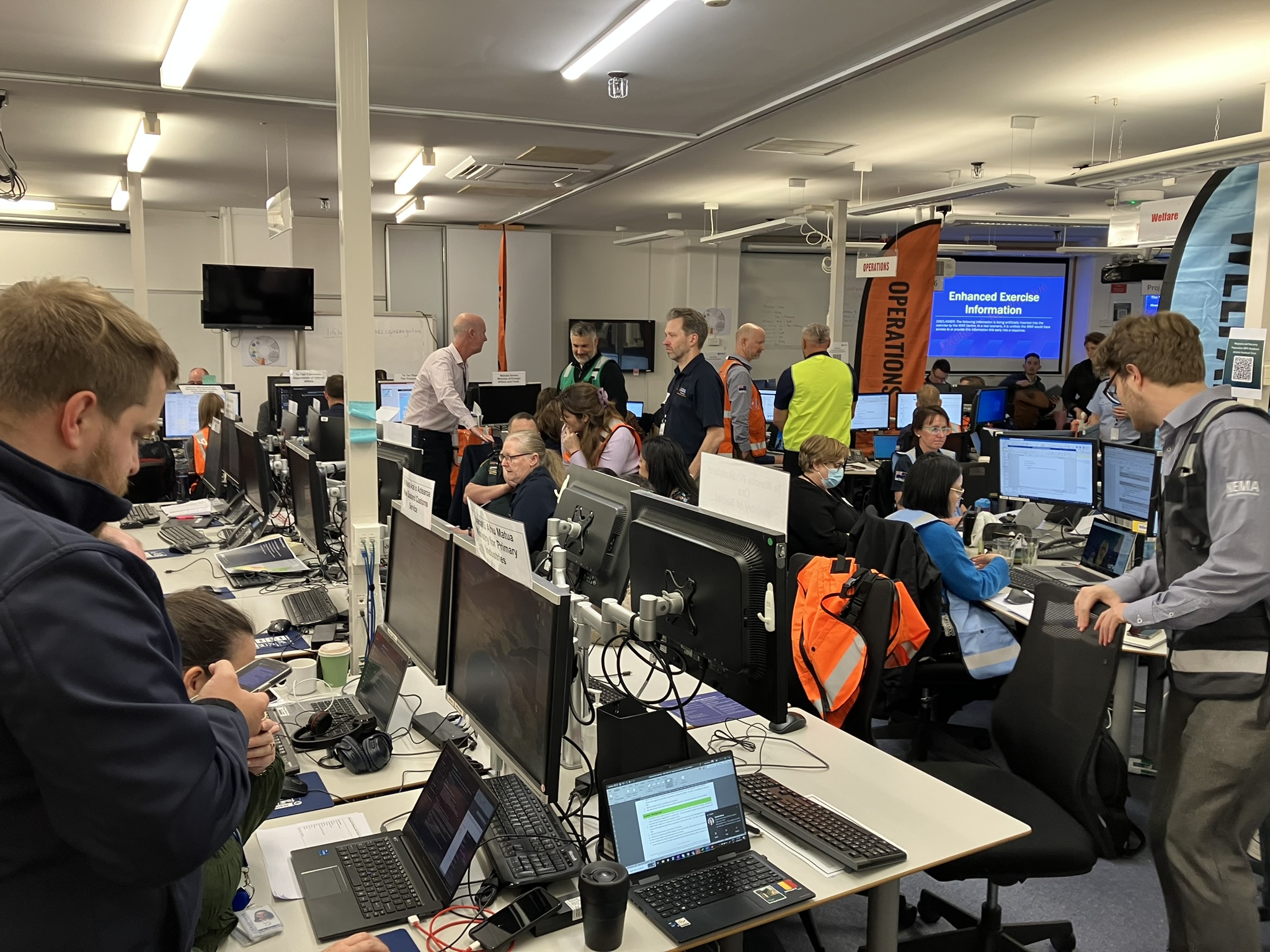
A hive of activity in the NEMA ʼbunkerʼ during the recent Rū Whenua exercise
Central to GNS’ advice was a suite of new innovative products, developed under the Rapid Characterisation of Earthquake and Tsunami (RCET) programme. RCET is developing and deploying state-of-the-art tools and techniques to monitor and rapidly provide critical information on earthquake and tsunami events.
The new tools use the most advanced science to determine the extent of an earthquake rupture, and its magnitude, evolution, shaking, and impact. They can quickly contribute to the developing picture of the scale of damage, potential landslide risk, tsunami threat, and loss of life. The RCET tools proved essential during Rū Whenua, building understanding of the event and its impact, and supporting decisionmakers deploying resources on the ground.
Earthquake insights
Within seconds of the earthquake occurring, RCET’s FinDer tool was tracking the rupture evolution, determining the magnitude, direction, and significant extent of the fault rupture. The team was able to confirm the simulated earthquake started in Te Anau and propagated several hundred kilometres northeast towards Hokitika.
Aftershock forecasting
Repeating patterns of seismicity from similar events in the New Zealand earthquake catalogue were used to detect and analyse simulated aftershocks and inform aftershock forecast models. This high precision method detects hidden aftershocks difficult to identify during periods of high seismicity where earthquake events overlap. During Rū Whenua, many smaller magnitude (M<3) and a few larger (M>4) aftershocks were discovered among the noise. Being able to include these otherwise unidentified events improves the accuracy of the aftershock forecast.
Shaking Layers (developed in partnership with the GeoNet programme)
Within 10–20 minutes of the exercise beginning, a Shaking Layers map indicated the strong to severe ground shaking intensity near the epicentre in Fiordland. Maps were updated as critical information came in from other RCET products, illustrating the severe to violent ground shaking intensity and the urban damage expected in Southland, along the West Coast, and extending into Canterbury. Shaking Layers was also used to spatially map earthquake-induced landslides from the earthquake.
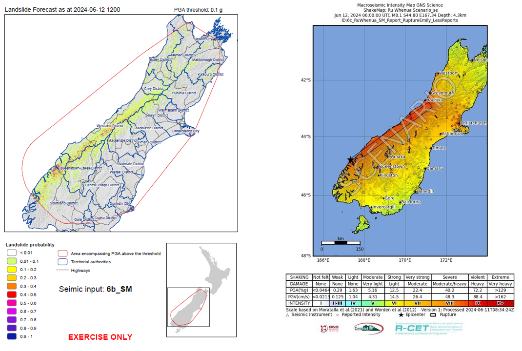
RCET powered landslide hindcast map and Shaking Layers map produced for the Rū Whenua exercise
Bill Fry, GNS Seismo-tectonophysicist and RCET programme lead, said Rū Whenua was a welcome opportunity to test the RCET tools in a simulated high-pressure environment.
“We were ecstatic with the increased situational awareness RCET tools and products provided for the exercise. The enhanced intelligence enabled more effective rapid response decision-making. Resources could be safely directed to the places where the greatest damage occurred from shaking and from secondary hazards – such as landslides and aftershocks,” Dr Fry said.
"We are encouraged knowing how well RCET products will serve emergency response agencies for the next ‘big one’. With the advancements being made under RCET, we also open up pathways for future research to tackle outstanding hazard challenges – such as earthquake early warning and forecasting locally generated, fast-approaching tsunami."
NEMA’s Chief Science Advisor, Professor Tom Wilson said said RCET innovations, as part of the well integrated and trusted science advice from GNS, were highly valued and timely for Rū Whenua.
"The science advice provided essential situational awareness and immediately helped inform wider response priorities," Professor Wilson said.
"The RCET products were part of a superb wider contribution from GNS Science and the Aotearoa New Zealand science system – which included standing up the ‘Science Desk’ sub-function within the National Crisis Management Centre and formal use of the Aotearoa Earthquake Science Advisory Panel."
NEMA’s Director of Civil Defence Emergency Management, John Price, said any capabilities that enable emergency managers to keep communities safe is a good thing for all.
“In an emergency, especially with the scale we exercised through Rū Whenua, science is critical to ensuring the management of the emergency can be done with informed and evidenced-based information. That is what enables the authorities and the community to be informed of the current and predicted risks,” John said.
RCET is funded by the MBIE Endeavour Fund and is delivered in partnership with iwi, a national network of researchers, local and national government, and international organisations.