
Looking for an earthquake?
While you can easily see the latest quakes we have located on our website and app, we also have a handy tool that lets you search through our whole earthquake catalogue, that goes back to 1815!
Our earthquake catalogue is where all the technical information about earthquakes is stored. If you think about how GeoNet detects about 20,000 earthquakes a year, that’s a huge amount of data to explore. All of our data is available on AWS (Amazon Web Services), and we have a blog on how to explore that here.
One way to explore this amazing catalogue of earthquakes is by using our interactive app QuakeSearch, this allows you to search for earthquakes by date, their size, and where they occurred. You can then view the data in several ways, including visually stunning maps, like the one we’ve created here.
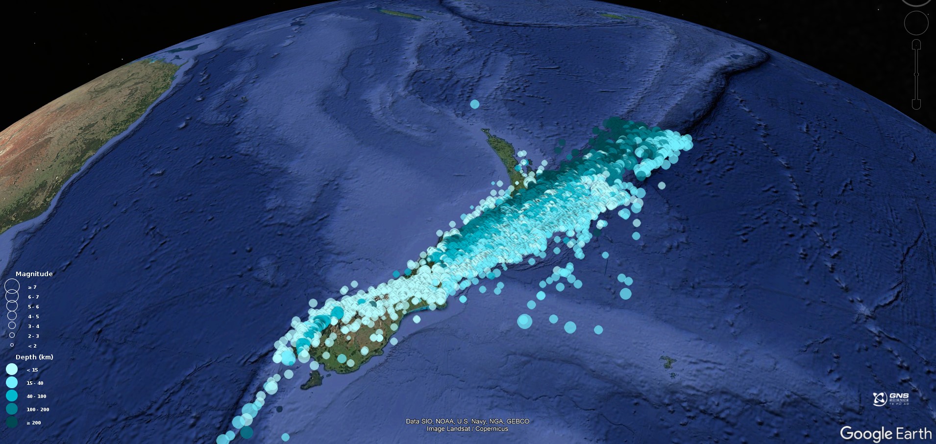
Earthquakes located by GeoNet in 2023
Tips for beginners
We have a tutorial that will take you through how to use QuakeSearch, use the ‘?’ at the bottom right of the QuakeSearch page.
When using QuakeSearch you will see we use Coordinated Universal Time, abbreviated as UTC (you can read more on UTC here). Currently New Zealand Daylight time is 13hr ahead of UTC.
What can you create?
To start out you can select a date range and area you are interested in, this will show the earthquakes on a map. You can click on each earthquake and get more information.
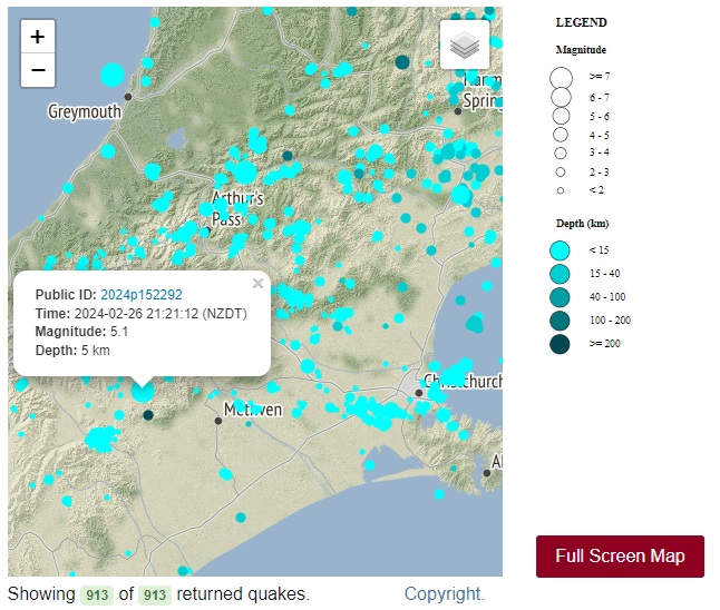
Example of ‘show on map’ view allowing you to select earthquakes for more information.
While exploring you might find out that QuakeSearch map visualisation is limited to at most 2000 earthquakes. This can make displaying earthquake patterns hard. A few scientifically backed tips for getting the most out of a map display:
Earthquakes typically follow a size distribution where there are 10x fewer earthquakes for every increasing unit of magnitude. So, increasing the minimum magnitude from 2 to 3 will give about 10x fewer earthquakes and so on for 3 to 4 etc. Of course you’ll miss many earthquakes from the map by doing this, but the broad patterns should still be visible at least at magnitude 3. However, many earthquake sequences have few or no larger earthquakes so increasing the minimum magnitude too high can drop these from the query. Experiment with the minimum magnitude to strike a balance between data volume and pattern clarity.
Earthquakes tend to cluster in space and time in areas of high strain and stress. For example, near the plate boundary, around previous earthquakes or in areas with dynamic changes in fluid concentrations, like the Taupō Volcanic Zone and its geothermal fields. Moving the map extent or co-ordinates away from these regions will drop the number of earthquakes returned.
Lastly, earthquakes happen frequently all over Aotearoa New Zealand. Limiting the time window and overall map extent of the query will reduce the number of earthquakes returned.
If you want to visualise more than 2000 earthquakes on a map, don't worry, we have options for that too! Instead of selecting ‘show on map’ if you choose ‘Build Query’ there are a variety of Output formats. CSV will give the data in a spreadsheet, and if you select KML you can download a file to open in Google Earth, like the below image.
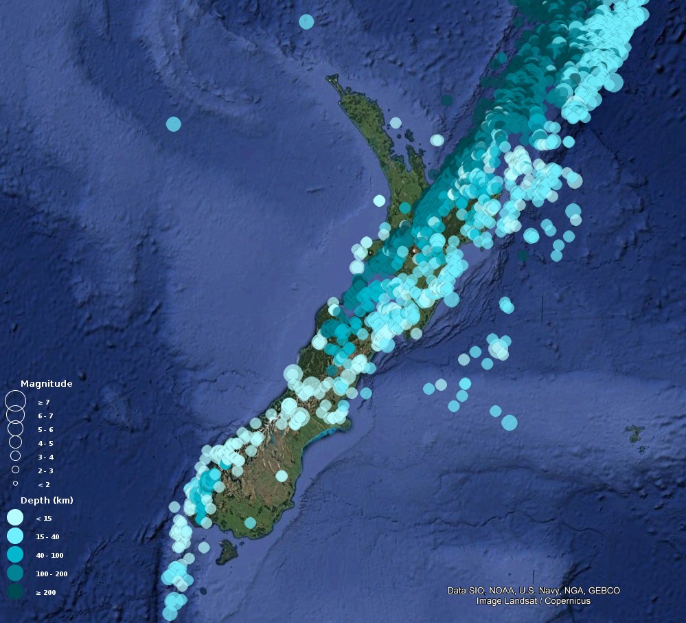
Example of a KML output file opened in Google Earth.
So why do we get so many earthquakes in Aotearoa New Zealand? Watch our video and find out!
Are you ready to ShakeOut?
ShakeOut takes place across the world to remind people of the right action to take during an earthquake. New Zealand ShakeOut is our national earthquake drill and tsunami hīkoi. ShakeOut 2024 is happening Thursday 24 October!
ShakeOut is a self-run drill, all you need to do is Drop, Cover, and hold for 60 seconds and practice your evacuation if you are in a tsunami zone.
For a local source tsunami, which could arrive in minutes, there won’t be time for an official warning. It is important to recognise the natural warning signs and act quickly. Practicing your tsunami hīkoi (evacuation) means you know where to go if there is a Long or Strong earthquake.
So far over 606,800 New Zealanders have signed up for New Zealand ShakeOut 2024, have you? Sign up here.
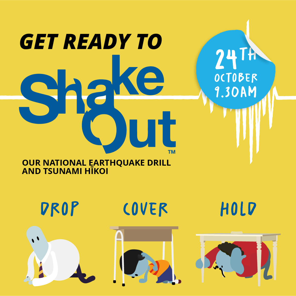
ShakeOut 24 October 9:30AM.
Earthquakes can occur anywhere in New Zealand at any time. In the event of a large earthquake: Drop, Cover and Hold.
Remember Long or Strong, Get Gone : If you are near the coast, or a lake, and feel a strong earthquake that makes it hard to stand up OR a weak rolling earthquake that lasts a minute or more move immediately to the nearest high ground or as far inland as you can, out of tsunami evacuation zones.
Know what to do?
The National Emergency Management Agency (NEMA) has a great website with information on what to do before, during and after an earthquake.
Prepare your home. Protect your whānau.
There’s a lot we can do to make our homes safer and stronger for natural hazards. Natural Hazards Commission Toka Tū Ake's website has key steps to get you started.
Media Contact: 021 574 541 or media@gns.cri.nz (For News Media only, thanks)