MultiGas system advances GeoNet’s automatic monitoring of our active volcanoes
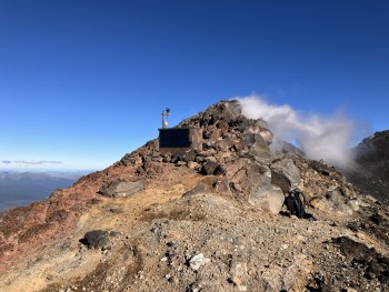
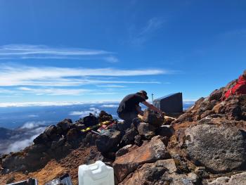
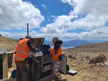
In March, GeoNet took a major step towards automating the monitoring of our active volcanoes by establishing MultiGas systems to collect data at Ngauruhoe and Te Maari Crater, in the Tongariro National Park.
What are MultiGas systems?
Carbon dioxide (CO₂), sulphur dioxide (SO₂), and hydrogen sulphide (H₂S) gases are emitted through gas venting fumaroles on many active volcanoes and provide critical information for our volcano monitoring team. Building our understanding of the gas emissions helps to detect and confirm eruptions and improves forecasting changes in activity. MultiGas systems automatically measure the concentrations of these gases around the clock.
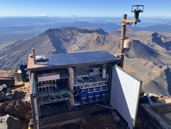
The MultiGas systems have CO₂, SO₂, and H₂S sensors, filters, and plastic tubing and valves to direct air to each of the sensors. An automatic calibration system uses gases of know concentration that are fed to the sensors weekly. The main part of the gas measuring system is about the size of a large shoe box.
The MultiGas systems are connected to data loggers we already use to make a variety of observations at volcanoes and landslides. The dataloggers automatically retrieve and store data, and make it accessible. MultiGas data are available through GeoNet’s Tilde data delivery application.
MultiGas systems have been used overseas for a few years in a small number of countries including in the United States, Italy, and Japan, but the technology is still relatively new and not yet widely used. MultiGas systems in different countries have much in common but they are designed and built specifically to suit each volcanic environment and data collection system.
Why do we monitor volcanic gas?
Volcanic gases offer a unique view into active volcanoes because they are the only part of the magma that can reach the surface before an eruption. CO₂ is normally the first gas released from magmas as they rise towards the surface, whereas SO₂ and H₂S are released later, when magma is closer to the surface. Changes in the relative amounts of the gases can indicate changes in the depth of the source magma.
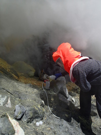
Until now, measuring CO₂, SO₂, and H₂S has required gases to be collected from a plane circling a volcano, or by visiting a fumarole and collecting samples for later laboratory analysis. While these provide excellent quality data, they can usually only be done monthly, and leave gaps in our information bank. Automatic 24/7 gas monitoring closes the gaps between manual measurements and increases the likelihood we will spot changes in gas concentrations before an eruption.
Additional sites are likely to be installed at other volcanoes once we have completed testing and fully implemented the new MultiGas systems.
Planning on visiting the Tongariro National Park?
Find out more about Tongariro and other New Zealand volcanoes here.
For information on access to the Tongariro National Park area, please visit the Department of Conservation’s website on volcanic risk in Tongariro National Park and follow their Facebook page for further updates.
You can read all of our Volcanic Activity Bulletins here.
Although we can’t prevent natural hazards, we can prepare for them – and we should.
The National Emergency Management Agency's (NEMA) Get Ready website has information on what to do before, during and after volcanic activity.
During volcanic activity, follow official advice provided by your local Civil Defence Emergency Management Group, the Department of Conservation (for visitors to the Tongariro and Taranaki National Parks), local authorities and emergency services.
Prepare your home. Protect your whānau.
There’s a lot we can do to make our homes safer and stronger for natural hazards. Toka Tū Ake EQC’s website has key steps to get you started.
Media contact: 021 574 541 or media@gns.cri.nz
