No further eruptive activity at Whakaari/White Island. Volcanic Alert Level lowered to Level 2 and Aviation Colour Code lowered to Yellow.
A minor, short-lived eruption occurred at Whakaari/White Island today around 8:20 am NZST. An observation flight over the volcano confirmed minor ash had been deposited onto the northern part of the island. No further eruptive activity has occurred since this morning. The Volcanic Alert Level is now lowered to Level 2 and the Aviation Colour Code to Yellow.
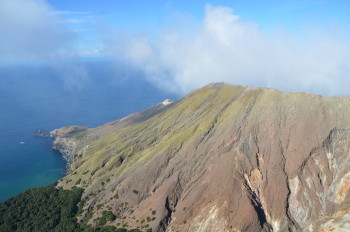
The minor volcanic eruption this morning at Whakaari/White Island emitted a 2-3 km high steam and gas plume. The size of the eruption was much smaller than the previous eruption at Whakaari/White Island in December 2019. During a subsequent observation flight over the island today, we noted a thin layer of ash had been deposited downwind on the northern flanks of the island (Figure 1). Activity on Whakaari/White Island has now returned to more normal levels with steam and gas emissions from active vents. We have not recorded any signs of further eruptive activity following this morning’s eruption.
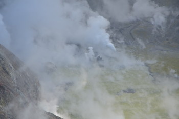
Geysering in the crater lake is still occurring, as has been observed for several months. Today, however, geysering activity was stronger than what we have seen in the last few months, regularly ejecting material 20-30 m high for several seconds (Figure 2). These observations suggest that the eruption this morning was most likely gas driven and we have no indications of fresh magma being close to the surface. We are preparing a gas flight for Monday to measure current levels of gas emission.
Steam and gases obscured the active vent area, so we are unable to confirm changes in the vent. The water level of the crater lake has subsided and some of the lake floor is now exposed. In the current south-westerly wind condition, volcanic gases, and ash (if present) will be carried out to sea with no impacts expected on the mainland.
Whilst we are currently unable to monitor the island in real-time with instrumentation on the ground, we continue to make observation and gas measurement flights as often as required to monitor the overall level of activity of the volcano. These are complemented by webcam images from Whakatane and satellite-based ground deformation data approximately every 10 days, allowing us to monitor ground deformation trends. Daily satellite-based SO2 emission measurements complement our more sensitive but less frequent gas measurement flights. Neither of these satellite techniques have detected significant changes in the overall activity at the volcano over the past few months.
Due to the absence of further eruptive activity and the relatively small size of today’s eruption, we have lowered the Volcanic Alert Level to Level 2 (moderate to heightened unrest) and the Aviation Colour Code to Yellow.
The Volcanic Alert Level reflects the current level of volcanic unrest or activity and is not a forecast of future activity. While Volcanic Alert Level 2 is mostly associated with volcanic unrest hazards (including discharge of steam and hot volcanic gases, earthquakes, landslides, and hydrothermal activity), potential for eruption hazards also exists and eruptions can still occur with little or no warning.
Further information about the Volcanic Alert Levels and what they mean can be found here.
GNS Science’s National Geohazards Monitoring Centre and Volcano Monitoring Group, through the GeoNet programme, continue to monitor Whakaari/White Island for further changes in unrest. We will provide an update on the current situation on Monday or earlier should the activity at Whakaari/White Island increase again.
Volcano Monitoring Group
Media contact: 021 574541 or media@gns.cri.nz


