Volcanoes
The Kermadec Islands include Raoul Island, 1,000 km north-east of New Zealand.
The Kermadec Island chain, 750 to 1,000 km north-north-east of New Zealand, are of volcanic origin. They are uninhabited, except for Raoul Island where a team of Department of Conservation staff carry out weed control work and make meteorological observations. All the islands are scientific reserves for the protection of fauna and flora. There are also many submarine volcanoes, such as Healy, Giggenbach and the Rumbles.
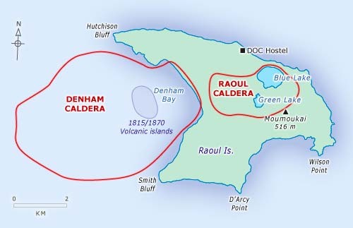
The Islands are the summits of large volcanoes that have been built up on the crest of the Kermadec Ridge, and have emerged above sea level. The ridge stretches for 600 to 700 km north-north-east, and has been upraised by the ongoing collision between the Pacific and Australian plates. Raoul Island is the summit of a large submerged massif about 35 km by 20 km; it is an anvil-shaped island about 30 km2 in area, and contains a large central depression (caldera) formed largely by subsidence immediately after large eruptions. Just west of Raoul Caldera is Denham Bay, a second caldera which has been flooded by the sea.
Most Recent Eruption
- When
- 17 March 2006
- Where
- Raoul Island
- Effects
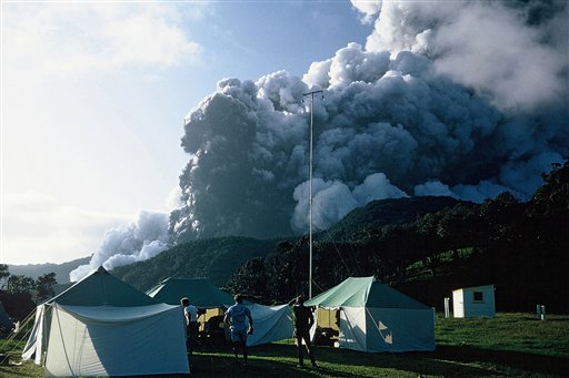
- Following a strong sequence of earthquakes the previous week, Raoul Island erupted without warning at around 8:20 in the morning. Rocks and mud were ejected from the Green Lake area. Equipment on the island showed the eruption continued for around 30 minutes. Scientists believe the eruption was caused by shaking of an existing magma chamber beneath the island by a nearby earthquake swarm. The shaking caused a sudden release of volatiles from the existing magma which accumulated beneath a sealed hydrothermal system until the pressure was great enough to blow the seal and cause the eruption. No evidence for new magma has been found as yet. Satellite images taken after the eruption confirmed that the volcano belched 200 tonnes of sulphur dioxide during the eruption and in the following 5 hours. Tragically, a Department of Conservation employee was killed by this eruption.


