M 6.2 Eketahuna Mon, Jan 20 2014
This quake was widely felt in both islands. Strong shaking was reported as far as Palmerston North and Masterton.
- Magnitude: ML 6.2
- Casualties: No casualties reported
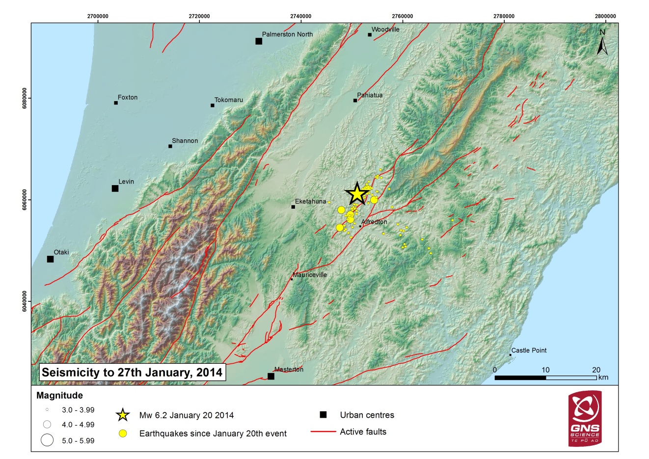
The Eketahuna quake struck at 3:52 pm on Monday afternoon, and was centered 15 km east of Eketahuna, under the south-east of the North Island. The quake was felt strongly in both islands, and over 9.000 felt reports were received from the public, with multiple reports of damage. The focal mechanism showed it to be a normal fault earthquake.
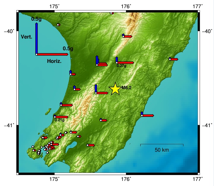
The depth and location of this event placed it below the interface between the subducting Pacific plate and overriding Australian plate. Maximum peak ground acceleration recorded by GeoNet instruments was about one quarter of the acceleration due to gravity (0.26 g). This measurement was recorded in Woodville. Relatively strong shaking was also recorded on the Kapiti Coast (e.g. up to 0.2 g in Paraparaumu) whereas accelerations recorded in Wellington city were less than 0.05 g. In comparison, ground motions recorded in Wellington during the Cook Strait earthquakes six months earlier ranged up to 0.26 g.
Within five days a set of possible future scenarios and their likelihood was compiled and released, to better inform both responding agencies and the community.
GeoNet science response activities
- A helicopter reconnaissance by GNS Science staff members was undertaken on 25 January to assess areas of ground damage associated with the earthquake.
- GNS Science and GeoNet deployed three strong-motion sensors to the region to supplement the permanent GeoNet network.


